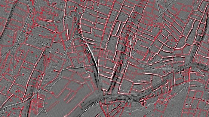
Aerial Laser Scanning revealed presence of a prehistoric farming in the area between Arun river valley in West Sussex and Queen Elizabeth Country Park in Hampshire. The LiDAR survey produced images showing that a field system already protected as a scheduled monument was just a small part of a vast swathe of later pre-historic cultivation. The pattern of prehistoric fields extended under a now wooded area between Lamb Lea Woods and Charlton Forest.
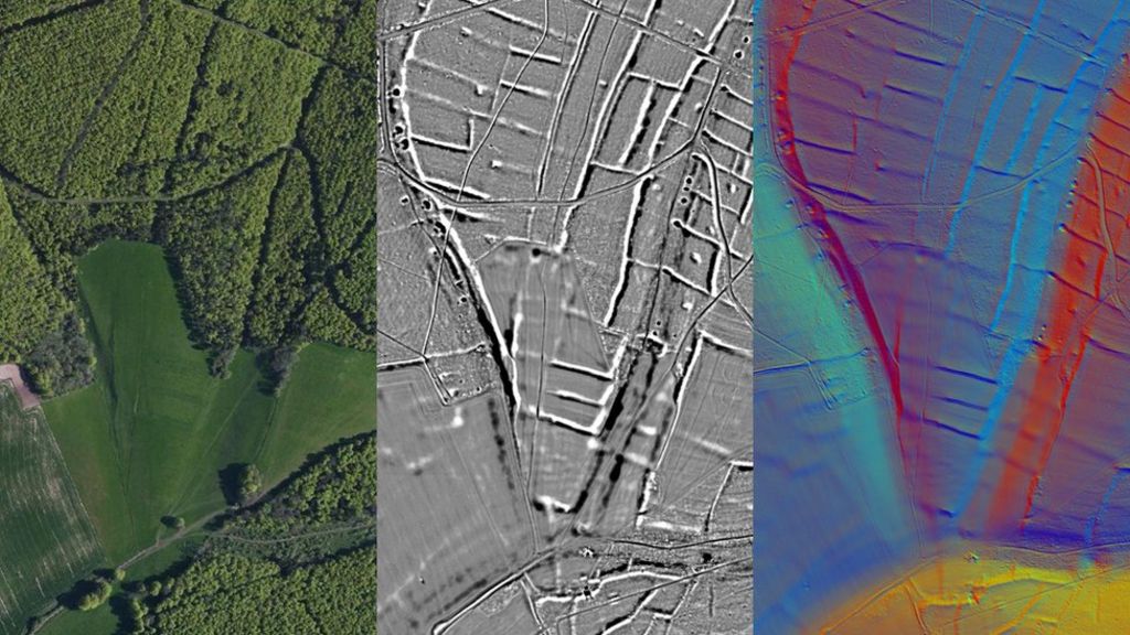
Downs National Park Authority state that the scale is so large that it must have been managed, suggesting that this part of the country was being organised as a farming collective. Beside the prehistoric farms the survey also revealed the route of a long-suspected Roman road between Chichester and Brighton. The route of the missing link in in the Roman road west of Arundel suggests the Romans would have headed out from their settlement at Chichester on Stane Street, the road to London, before branching east towards Arundel.
(after BBC News)