Machu Picchu’s new terraces discovered through LiDAR

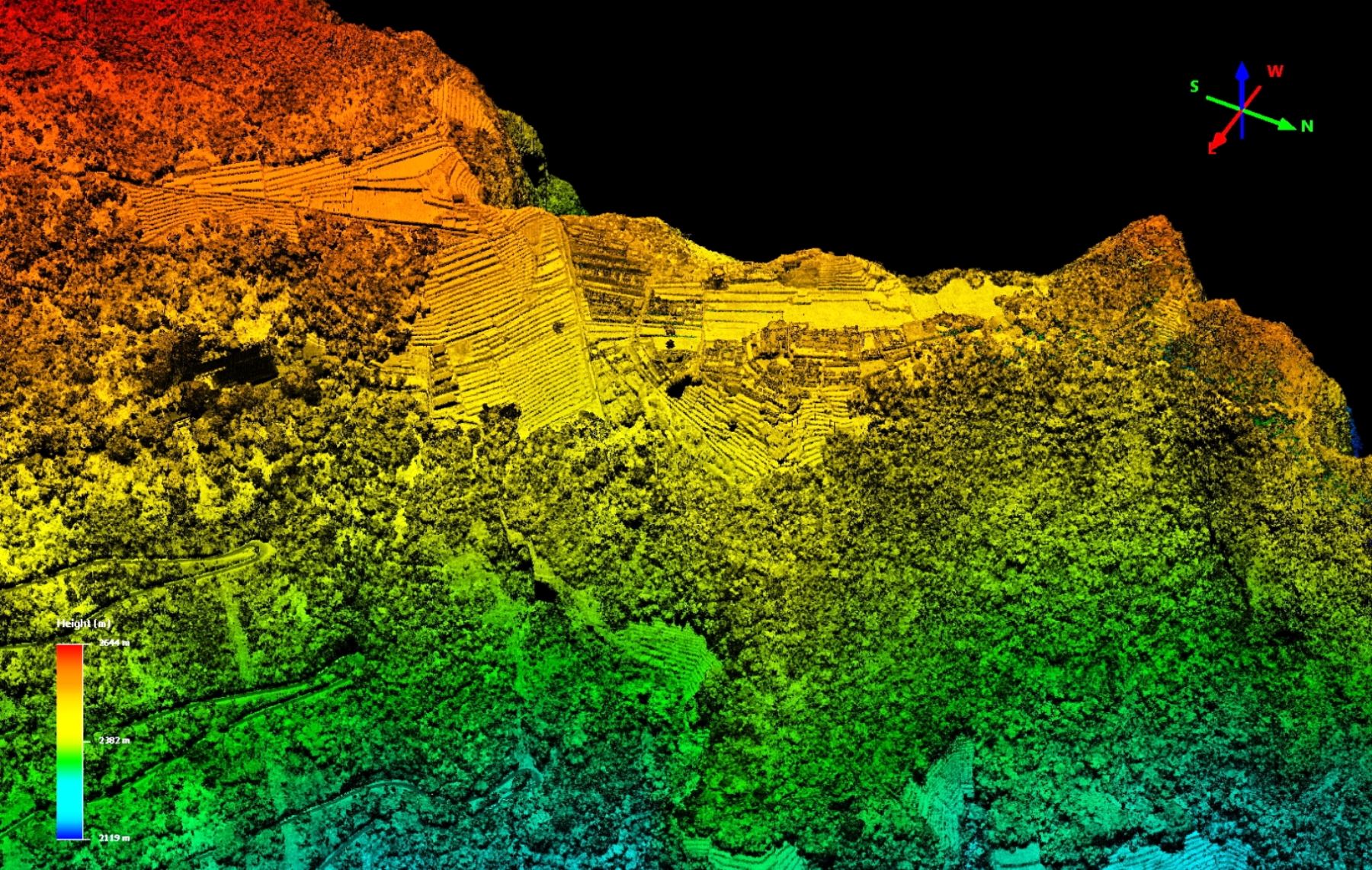
LiDAR technology helped researchers to uncover evidence of architectural structures hidden under vegetation in the vicinity of Machu Picchu in Peru. Among the newly discovered structures are terraces and platforms and pathways of the Inca Trail stretch. The discovery was made by a team led by Roland Fletcher of the University of Sydney.

Machu Picchu (by Andina)

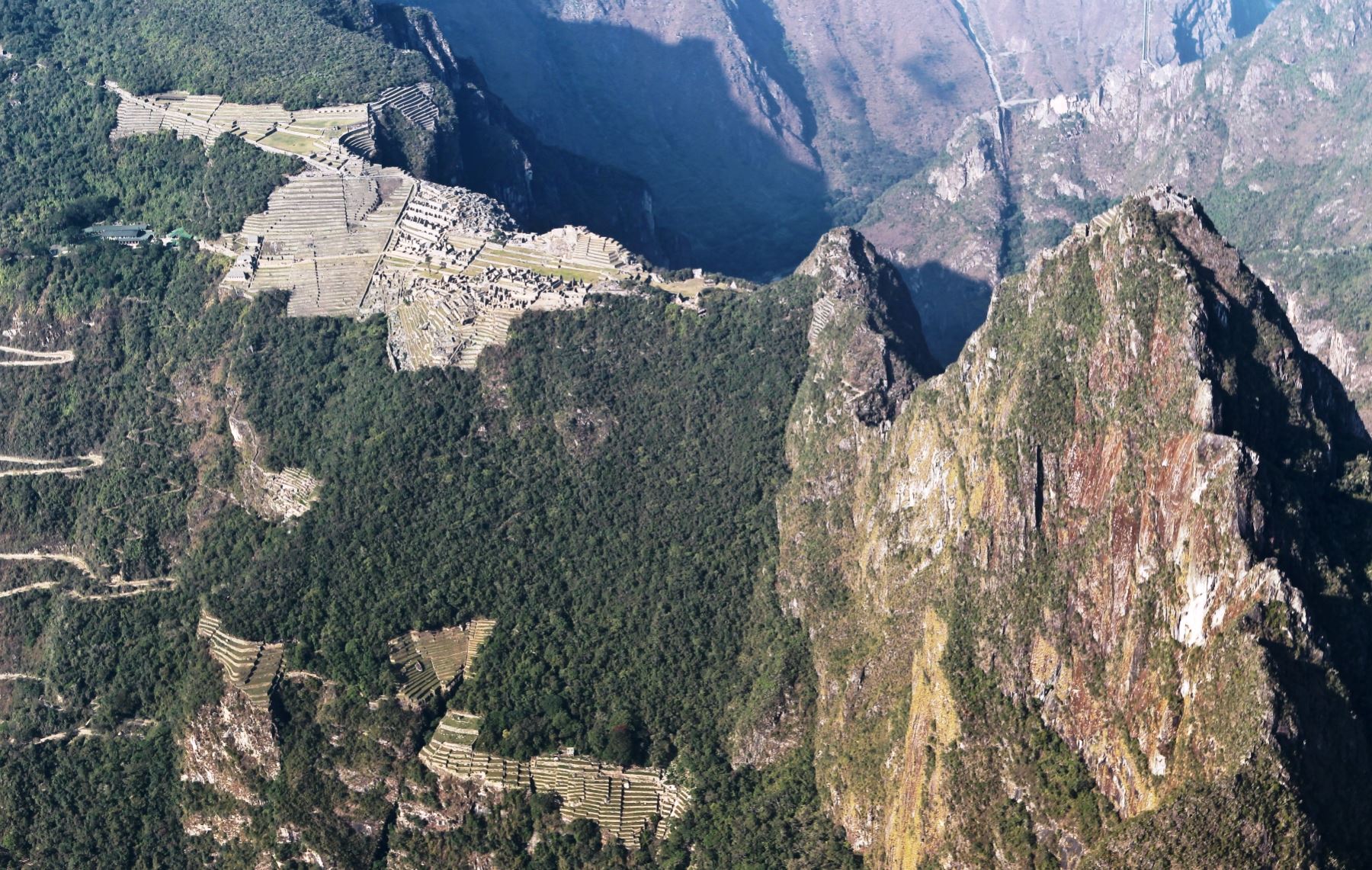
Applied technology helped to reveal Incan buildings on the hillside of the citadel through aerial and three-dimensional images. They portray not only buildings, features of the landscape, including previous slides and erosions.

Digital model of the Airborne Laser Scanning data (by Andina)
Textures
Digital model of the Airborne Laser Scanning data as pointcloud with photo textures (by Andina)

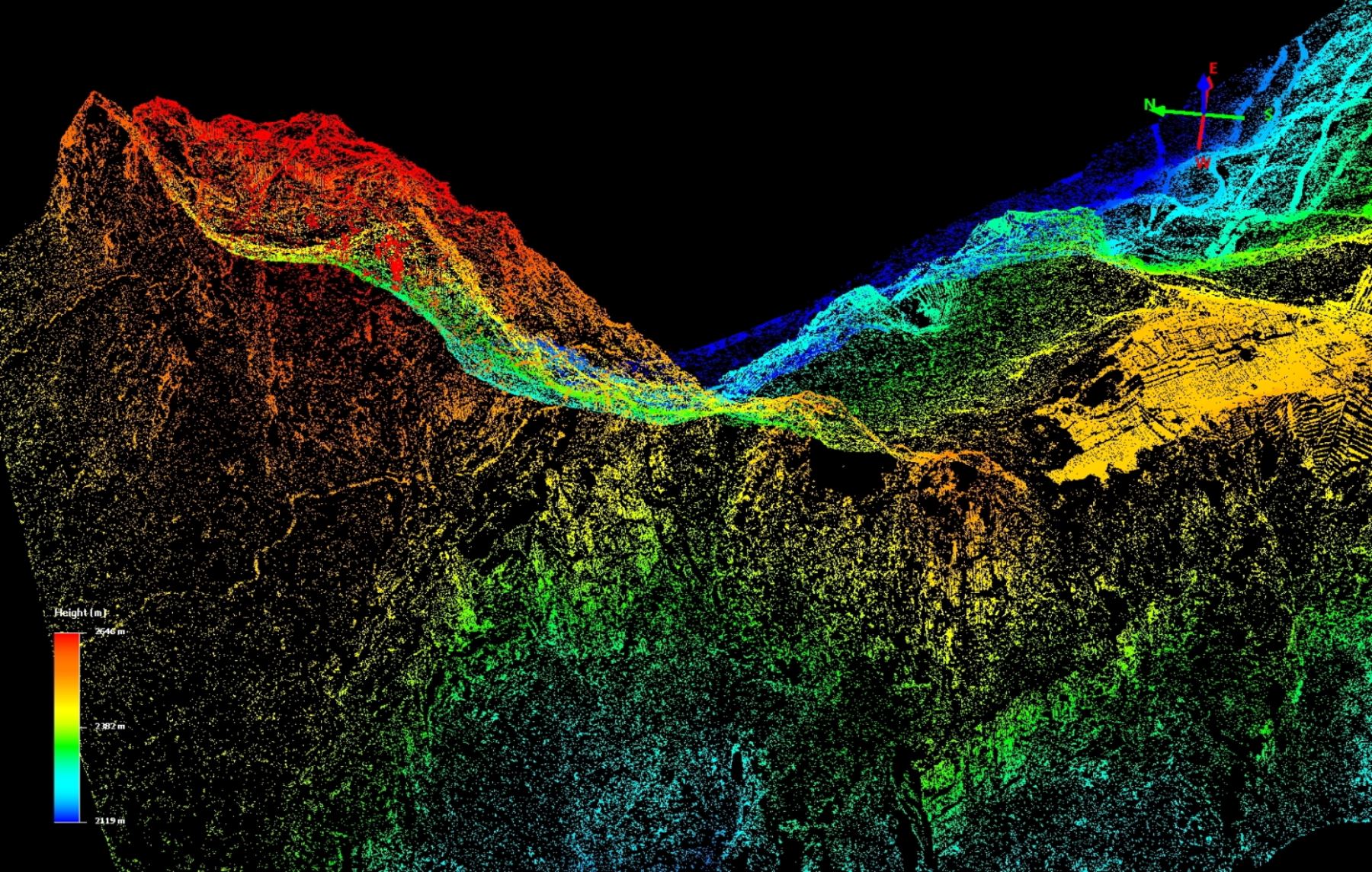
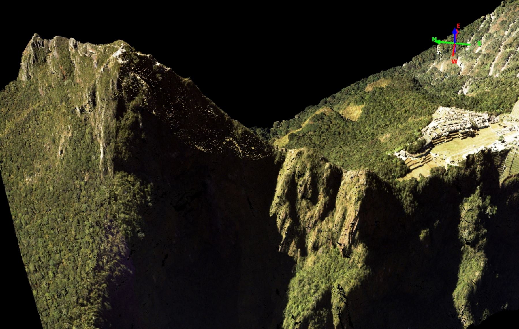
The images depict additional trails and provide evidence of terraces and forms that are likely to be constructions or stairways. This new date will be very helpful to point out places where to carry on future research.

Digital model of the Airborne Laser Scanning data - visible terraces and architectural structures (by Andina)
Digital model of the Airborne Laser Scanning data – visible terraces and architectural structures (by Andina)
Equipment used in the research (by Andina)

(after Andina)

Leave a Reply

Your email address will not be published. Required fields are marked *

This site uses Akismet to reduce spam. Learn how your comment data is processed.