Archaeologists conducting an aerial survey over 10 ancient sites in northern Guatemala have identified over 60000 new Maya structures, including pyramids, causeways, house foundations and defensive fortifications, through LiDAR scans of the jungle area.
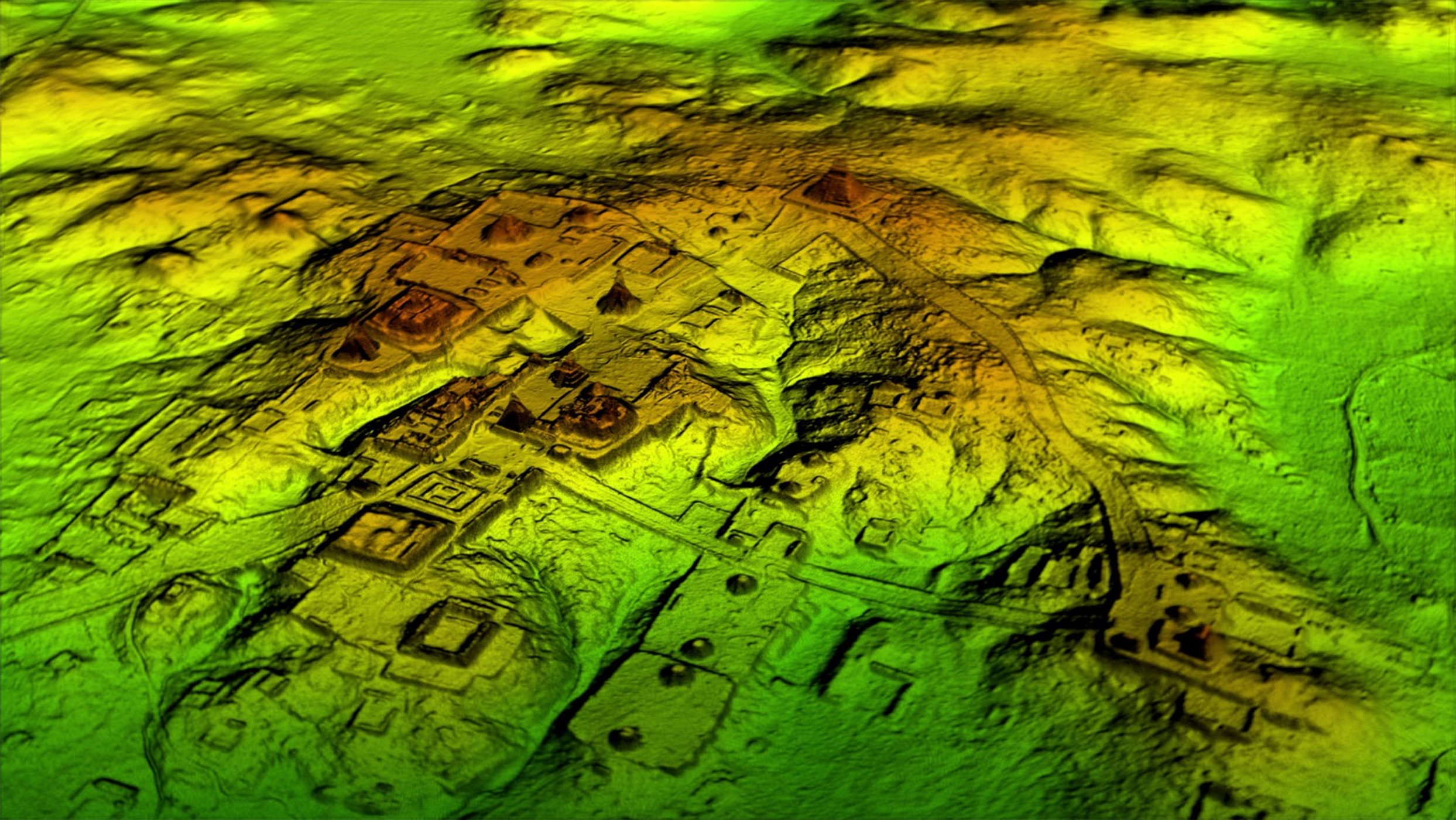
The survey covered 2100 square kilometres over 10 Maya sites. Researchers discovered structures that had never been mapped before, some in very well-researched Maya sites. Others were spread far and wide through the jungle. According to Tom Garrison, archaeologists of the Guatemala’s PACUNAM LiDAR Initiative, most of the new finds are probably stone platforms that supported the pole-and-thatch homes of average Maya people. But the surveys also turned up features that are probably pyramids, causeways and defences.

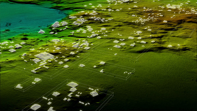
To the archaeologists, the interesting places are also where there are no structures – as if the Maya chose some places not to live in. It is believed that investigating their choices about where to settle might reveal more about how they farmed and used water. What the researchers find also stunning is the number of roads and extent of the road network that the Maya built. These roads wouldn’t have served as pathways for carts or wagons. They may have functioned as causeways during the swampy rainy season, she said, or as platforms for processions. A vast network of roads has been discovered in the 2016 season near the site known as El Mirador, or Kan Kingdom – the cradle of the Maya civilisation.
(after Live Science, Wild Blue Media & National Geographic)