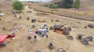
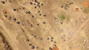
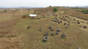
As archaeological investigation at the Plain of Jars in Xieng Khouang province of Laos continues, archaeologists create a three-dimensional virtual reality to document and allow for remote exploration of the mysterious site.

The site consists of thousands of scattered stone vessels which purpose yet remains unknown to the scientists. Archaeologists of Australian National University and Melbourne’s Monash University used drones to access the parts of the site that remained unavailable due to unexploded mines and bombs dropped during the Vietnam War.

The drone flying over the site captures 3D images every 10 centimetres in order to create a detailed and accurate image of the site. The experts also use multispectral cameras and airborne laser scanning technology (LiDAR) to create centimetre-accurate maps.

Earlier this year archaeologists uncovered ancient human remains and traces of various burial practices at the Plain of Jars. The recent investigation is a part of the endeavour to explore the site as it has a pending application to the UNESCO World Heritage list.
(after New Atlas, PhysOrg)