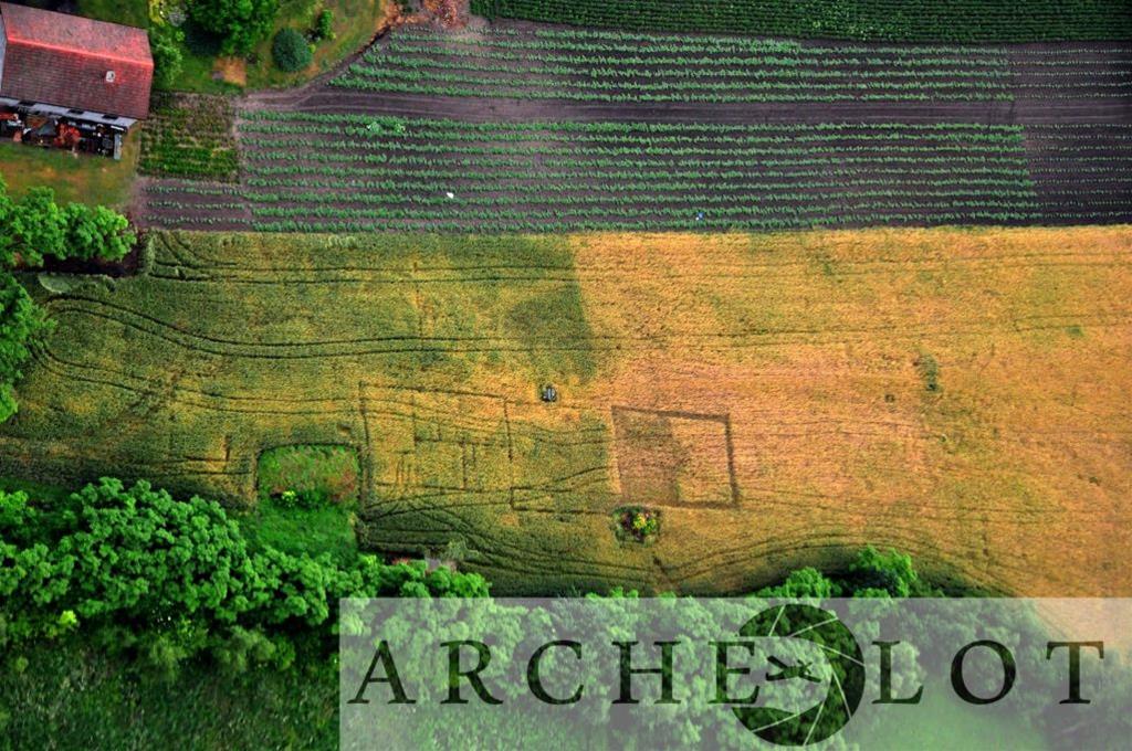
Annual season of aerial prospection in South Poland brought excellent results this year. Archaeologists conducting the flights and prospection over the Nida river basin detected numerous archaeological sites and other features, indicating presence of relics of man-made structures. The most favourable factor for successful prospection this year was the drought that enabled the crops to reveal normally hidden archaeological features. Archaeologists Piotr Wroniecki and Krzysztof Wieczorek, conducting the annual prospection over southern Poland documented soilmarks and cropmarks that possibly indicate the presence of archaeological structures within the ground. This year they were able to capture numerous features of both prehistoric and modern structures existing within areas used for agriculture.
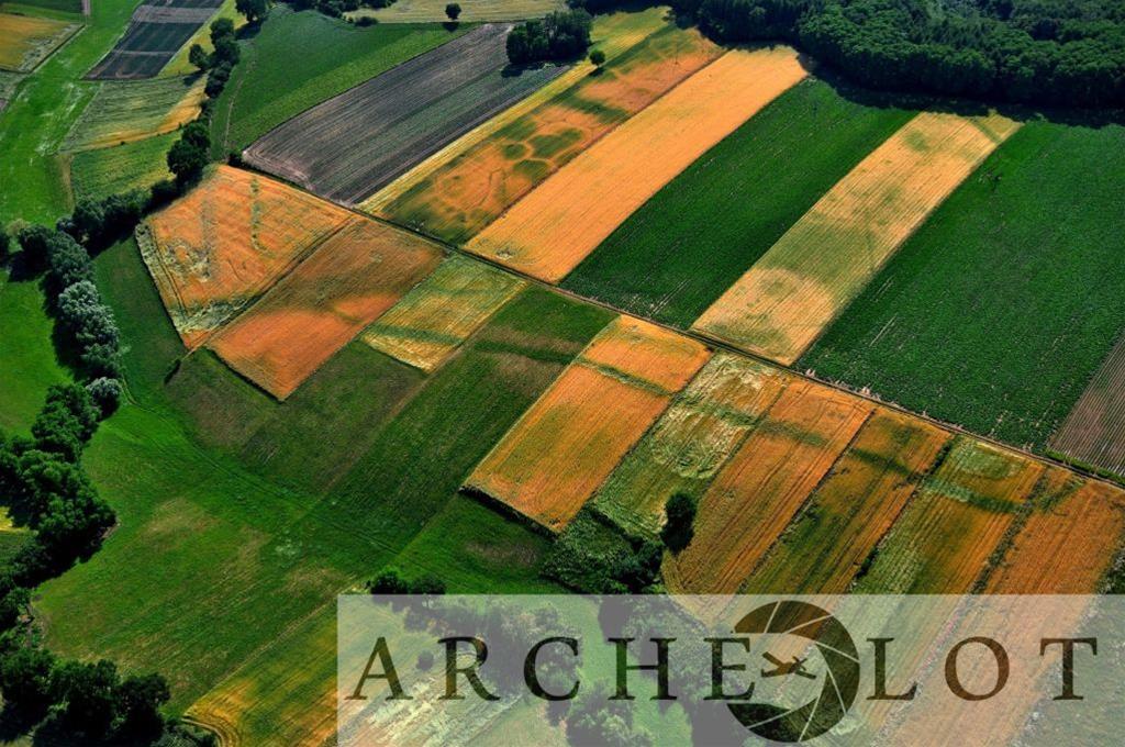
In the vicinity of Nowy Korczyn an outline of a structure without any analogies in Poland’s archaeology was spotted. It has a shape of a rectangle measuring 100 by 30 metres and is encircled by moats. It possible could have been also enclosed by a palisade. Similar fortified settlements are known to archaeologists from the United Kingdom and are dated to prehistoric times.
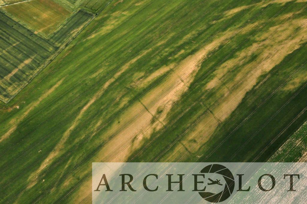
In the area of Rosiejów a previously unknown monumental Neolithic megalith was discovered. This construction built with wood and dirt in shape of an elongated trapeze is nearly 80 metres long and was meant as a burial mound for an important person of the prehistoric community.
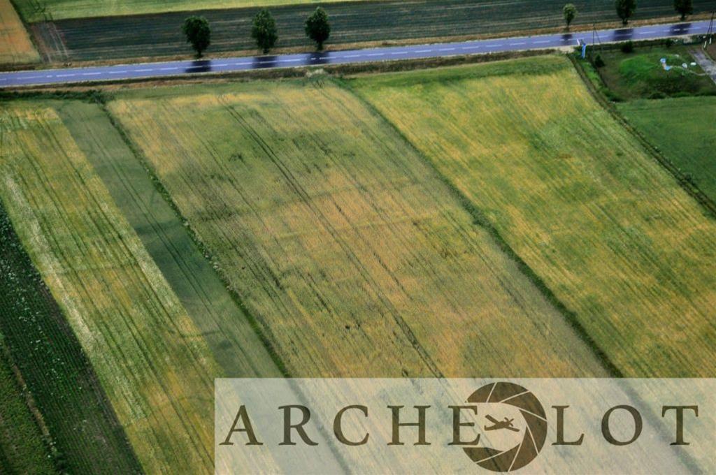
A wider spatial context of the known Neolithic settlement in Bronocice was also registered. The site is known for the oldest depiction of a wheel-cart on ceramic vessel dated back 5500 years. In a case of two sites that are close to each other through aerial photography, the archaeologists were able to determine that the cropmarks inform that it is just one, yet large archaeological site. More recent structures were also documents, such as old war trenches and relics of modern farms, palaces or residential structures.

This year’s season shows clearly that neither drones nor airborne laser scanning can replace aerial photographic prospection when it comes to detecting new sites and buried archaeological features. The prospection was a part of a larger project called “Hidden cultural landscapes of West Lesser Poland Loess Highlands. Non-destructive methods in archaeological settlement study”, financed by Poland’s National Science Centre.
(after Nauka w Polsce & Piotr Wroniecki)
Permalink //
I didn’t know it looks like that. I’ve just started to go deeply into archaeology and its methods. It is so great! Can I read about it more somewhere on your site or somewhere else?
Permalink //
We will bring you more news as the issue develops, so keep on following our site and drop by more often.